

Top Geomatics Drone Simulator Platforms for Realistic Terrain Mapping Practice
2026-11-18
Most drone simulator roundups read like spec sheets, but realistic terrain mapping practice asks for more than a smooth flight model and a pretty horizon. If you are preparing for geomatics work, the gap between simulated data and messy real-world terrain is where accuracy actually falls apart. This guide looks at platforms that reproduce uneven ground, vegetation noise, shifting light, and the small mistakes that turn into expensive reflights. Among the tools worth close attention, SRIZFLY treats simulation as a rehearsal environment rather than a game. Here are the top options and what each one really teaches you before you leave the ground.
Where Simulated Physics Meets Survey-Grade Expectations
Most simulation tools treat physics as a rough approximation, rounding the corners until the numbers feel believable. This platform works the other way: it lets real sensor noise, multipath, drift, and vibration interact with a synthetic environment that has been tuned to behave like a job site, a corridor, or a steep grade. The result is not a clean ideal path, but a messy, repeatable dataset that exposes where a positioning pipeline actually bends.
That distinction matters when the deliverable is survey-grade. Small timing offsets, coordinate frame mismatches, and temperature-sensitive bias don't show up in simplified animations, yet they dominate residuals in the field. By coupling high-rate inertial propagation with constraint-aware GNSS updates, the simulation preserves those failure modes instead of hiding them. You can push the virtual receiver through canopy, metal structures, or sharp banking turns and watch the covariance respond the same way it would on hardware.
The payoff is iteration speed without losing traceability. A change to the filter, the antenna lever arm, or the outlier rejection logic can be tested against the same physically grounded scenarios that previously required a day of driving and post-processing. Teams end up tuning against evidence, not intuition, and the gap between simulated pass and field acceptance shrinks considerably.
Reading the Virtual Ground: Elevation Data and Mesh Detail
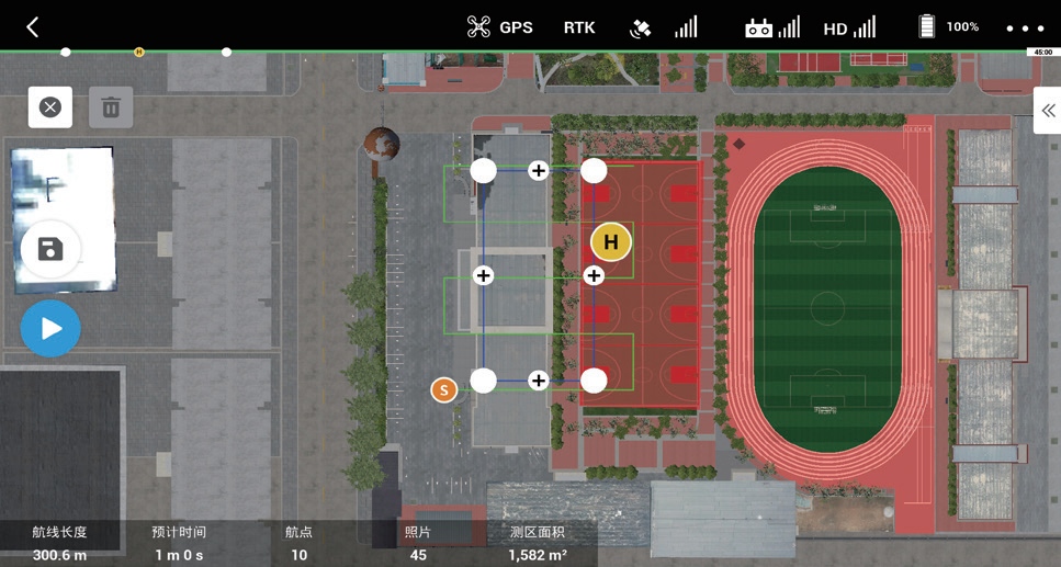
Elevation data rarely arrives ready to use. Raw point clouds and contour lines must be distilled into a continuous surface before a landscape can even begin to feel grounded. The finer the mesh, the more faithfully a gentle slope or a sudden embankment holds its shape. But density alone doesn't solve the problem of character. A well-tuned surface preserves the subtle breaks, the worn path, the crown of a dirt road, without flattening them into a uniform grid.
Working with terrain heightfields means learning to read where to spend detail. Broad, sweeping meadows can survive on relatively coarse triangles, while creek beds, curb lines, and rock outcrops demand tighter tessellation. The trick is to let the elevation model breathe in the right places. Instead of blindly subdividing everywhere, the surface should respond to slope change and water flow, so that a riverbank remains crisp underfoot rather than dissolving into a blur of interpolated noise.
This interplay between data resolution and mesh behavior shapes everything that happens later: vegetation placement, erosion effects, how light rakes across a hillside at dawn. If the underlying ground lacks believable variation, even the best textures will slide off it like a decal. But when the virtual ground carries real weight, small undulations and drainage patterns begin to tell a story that no amount of surface dressing can fake.
Payload Behavior That Mirrors Real Flight Characteristics
The gimbal doesn't snap to a stop when you release the stick. It settles the way a heavier camera rig would, carrying a fraction of momentum into the final frame and smoothing out abrupt corrections without feeling floaty.
Yaw movements show a slight lag behind the aircraft's heading changes, similar to a real nose-mounted sensor package reacting to inertia. Small vibrations and micro-adjustments read as natural airframe feedback rather than digital noise, which keeps the footage from looking locked to a rail.
When the drone banks into a turn, the payload's horizon line rolls and recovers at a rate that matches actual mass distribution. This gives the image a sense of weight and presence that is easy to overdo, but here stays subtle enough to convince without distracting.
From Classroom Scenarios to Field-Like Mission Planning
The shift starts quietly: a tabletop map replaces the whiteboard, and the scenario stops being a case study with a single right answer. Teams are handed fragmentary briefs, a fuel budget, a moving weather window, and told to produce a workable movement plan before the next update arrives. The markers and sticky notes are still there, but they now stand in for checkpoints, medevac routes, and comms relay points.
What changes most is the nature of uncertainty. In a classroom scenario, the instructor usually controls the pace and confirms whether a decision is acceptable. Once the exercise takes on a field-like shape, delays have consequences, map layers disagree, and one team member may be holding information that another team needs but never thought to request. The planning process becomes less about memorizing steps and more about negotiating priorities under pressure.
That transition also reveals assumptions that rarely surface in discussion-based learning. A route that looks direct on paper may be useless after a bridge status update, and a timeline that works in slides can collapse when radio checks and rest cycles are added. By the end of the session, participants are not just applying a planning format; they are reading terrain, guarding against their own optimism, and adjusting a plan as new constraints land on the desk.
Assessing Workflow Fit Across Planning and Post-Processing
Assessing fit means looking closely at how the outputs of the planning stage are actually consumed downstream, not just whether each phase feels efficient on its own. A workflow that produces tidy plans but forces constant reinterpretation during post-processing creates friction exactly where handoffs should be silent.
The planning side benefits from repeatable parameters, clear naming conventions, and the ability to compare versions without rebuilding context. Post-processing, in turn, calls for batch reruns, partial updates, and traceable outputs. When those two sets of expectations align, small changes stay small instead of rippling into manual cleanup.
A practical test is to follow a few real tasks through the entire chain and note where files, scripts, or human judgments have to be adjusted. If most changes cluster around a few stable interfaces, the workflow fits well. If every job demands new glue code or hand-editing, the boundary between planning and post-processing probably needs to be redrawn.
Separating Gimmicks from Dependable Training Tools
The market is crowded with gadgets that promise faster progress, but most of them solve problems nobody actually has. A dependable tool tends to be boring: it adjusts easily, holds up under repeated use, and fades into the background during a workout. If a product needs a lengthy demo or a celebrity endorsement to make sense, that is usually a sign the mechanism is less important than the marketing.
One practical test is to ask whether the tool changes the stimulus or just changes the feeling of effort. Cheap resistance bands with poorly anchored handles, balance boards bolted to squat racks, and apps that count reps with shaky accuracy often create novelty rather than overload. A reliable piece of equipment gives you clear feedback, lets you progress loading or volume in small increments, and does not introduce unnecessary instability.
Another useful filter is longevity. Ask a coach who has no financial incentive whether the item still gets used after six months. Tools that stick around tend to be simple, repairable, and compatible with existing programming. The flashy stuff usually ends up in a closet, not because it failed dramatically, but because it added friction to the session.
FAQ
A basic trainer stops at keeping the aircraft in the air. A geomatics simulator has to reproduce how the ground is sampled: camera trigger timing, image overlap, gimbal pitch, flight line spacing, and the way terrain relief changes those parameters. If the platform does not let you inspect a synthetic orthomosaic or compare planned versus actual coverage, it is only teaching stick control.
AirSim stands out because it supports custom heightmaps and physically based camera models, so you can fly a terrain model and generate image sequences that behave like a real mapping pass. Gazebo with a fixed-wing or multirotor model is more work to set up but gives useful control over wind and sensor noise. UgCS and DJI Flight Simulator lean toward operational planning and familiar flight interfaces, though their terrain feedback can feel limited for serious block adjustment work.
Compare the simulator's synthetic dataset against a small real dataset from the same kind of terrain. Look at overlap consistency, blur, exposure shifts across a flight line, and whether the reconstructed surface shows the same weak spots you would expect from real imagery. If the simulator cannot inject common failures like variable lighting, rolling shutter artifacts, or GPS drift, treat its results as planning practice rather than accuracy validation.
Yes, if you are willing to assemble pieces. AirSim and Gazebo are the usual starting points. You can import a digital elevation model, attach a downward-facing camera with realistic parameters, and script a survey grid. The realism comes less from the default settings and more from how carefully you model the sensor, overlap, and environmental factors. It takes more effort than a commercial flight trainer, but the payback is a repeatable testbed for mission logic.
Ground sample distance, field of view, shutter speed, ISO behavior, and the relationship between flight speed and motion blur matter more than visual polish. A camera model that treats every frame as perfectly sharp with identical exposure hides the exact problems that cause holes in a real reconstruction. The geotag error model also matters: if position and attitude uncertainty are absent, the simulated block adjusts too cleanly.
Most platforms handle flight dynamics adequately, but the photogrammetric chain is often simplified. Vegetation, water, shadows, moving objects, and surface texture that confuses feature matching are either missing or too clean. Simulated terrain can look convincing and still produce an unrealistically easy reconstruction because the surface lacks the noise and irregularity of a real site.
It can help with both, but the planning value depends on the platform. Some simulators let you run a mission from imported waypoints and check swath coverage, sidelap, and terrain-following behavior before you go outside. That is useful for catching bad altitude choices and gaps in complex terrain. Just be careful not to assume the simulated coverage is exactly what the real sensor will see.
Start with one messy scenario, not a full curriculum. Give learners a contour-rich area, a fixed sensor setup, and a target ground sample distance. Have them plan, fly, then export the image set and process it through the same photogrammetry software used in the field. Compare the recovered surface to the known digital elevation model. That single workflow exposes planning errors, camera settings mistakes, and processing limits far better than hours of free flight.
Conclusion
A simulator only earns its place in geomatics training when the physics model stops feeling like a game and starts punishing the same mistakes a real aircraft would. The most useful platforms pair believable inertia, wind response, and battery limits with terrain surfaces that retain survey-grade detail. Instead of smooth placeholder landscapes, they expose elevation breaks, mesh irregularities, and slope transitions that force you to read the ground the way photogrammetry outputs demand. Payload behavior matters just as much, so camera gimbal lag, exposure timing, and flight speed should alter image overlap and data quality in visible ways, leaving a poor flight plan with the same gaps it would create in the field.
Beyond raw flight feel, the stronger tools survive scrutiny in workflow tests. They let you move from tightly scripted classroom exercises into open mission planning where terrain, airspace, and project boundaries shape the route rather than a fixed tutorial path. Import and export steps should connect without friction to common photogrammetry and GIS pipelines, otherwise the practice remains isolated from real deliverables. The deciding factor is usually restraint. Reliable simulators avoid cinematic gimmicks that inflate confidence and instead offer repeatable conditions, useful telemetry, and failure modes that teach operators to notice problems before they become expensive field errors.
Contact Us
Contact Person: Niles Liu
Email: [email protected]
Tel/WhatsApp: 8619945009803
Website: https://srizfly.com/